Back
Animal Rescue
Use Cases
When you are a staff member of a "stray animal rescue organization", you can build an animal-related map within the organization in exping.
For example, animal rescue hospital welfare maps, rescue point maps, offline volunteer activity maps, adopted animal maps, etc., to facilitate organizations to track follow-up situations.
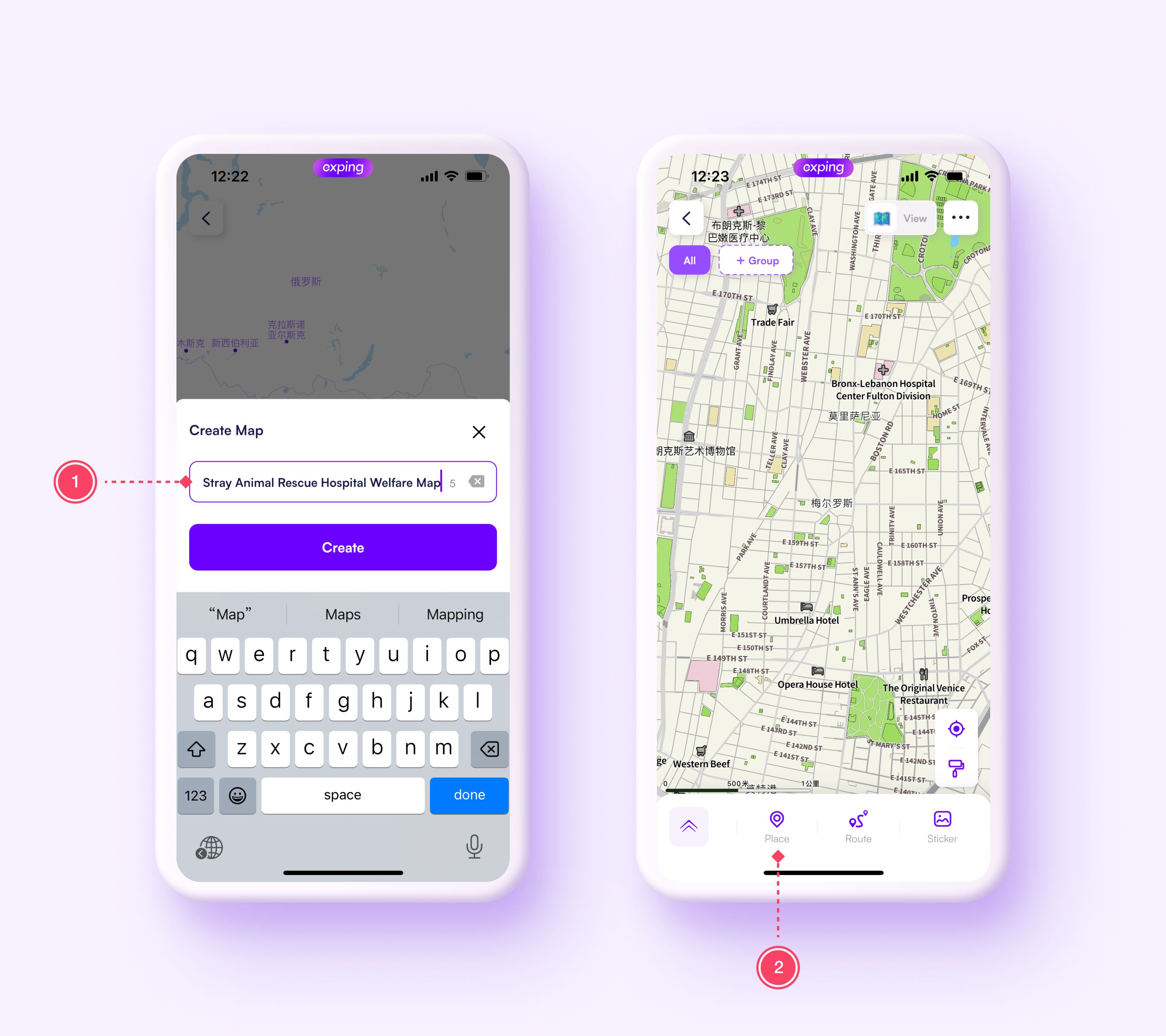
For example, create a welfare map of animal rescue hospitals
- Creat a map, and name it”Stray Animal Rescue Hospital Welfare Map”
- On the map editing page, click”Place”to mark the location of the relevant hospital on the map
To use the map more conveniently, you can try the following:
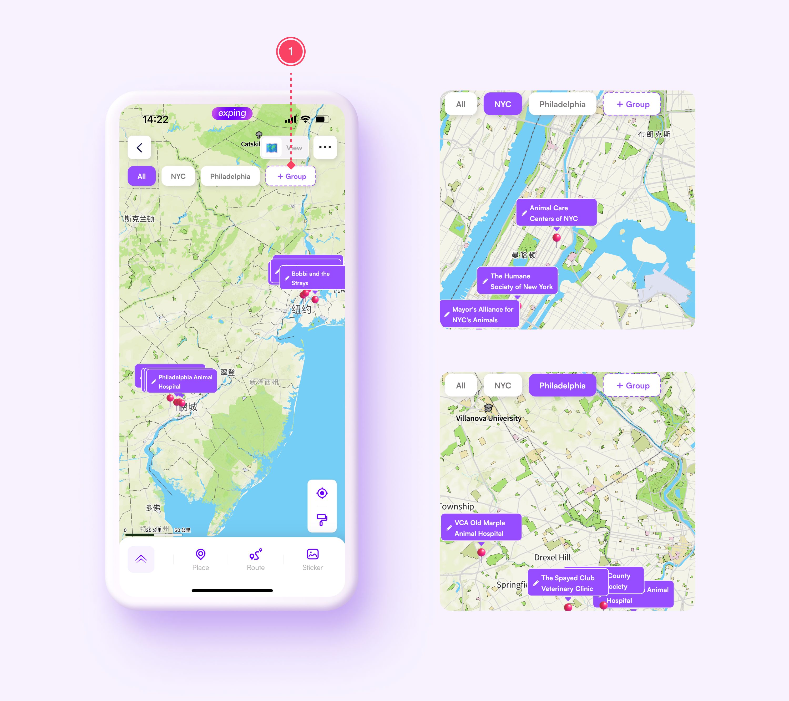
01 Use the grouping function to mark hospitals according to regional distribution
- Create new groups based on regional distribution
- Under the corresponding regional grouping, add relevant hospital locations
02 Use different emojis to mark rescue hospitals
Through different emoji marks, you can quickly know the hospital's key rescue animal types directly on the map.
03 Improve pet hospital related preferential projects, preferential groups and other information
- On the map editing page, click on the location page for which additional information is needed and click "Label”
- Customizable label name
- Add emoji that fit the label
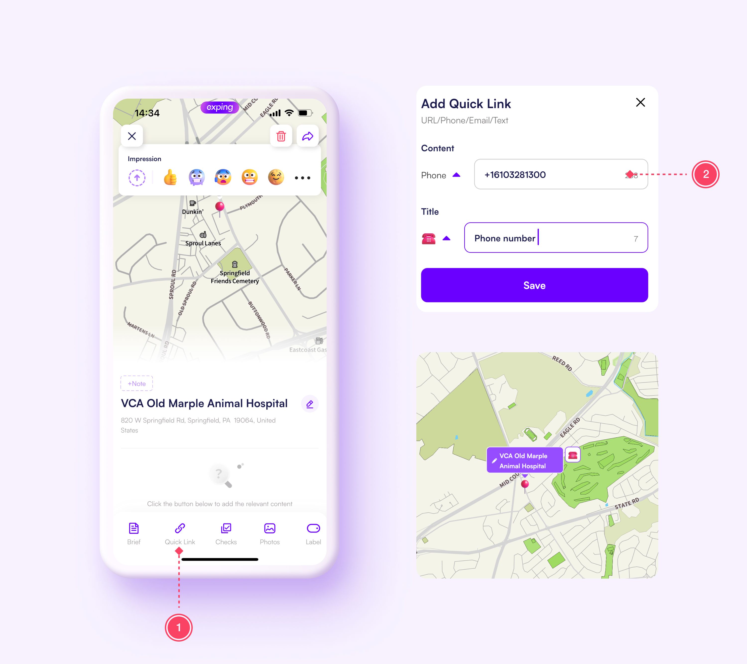
04 Add hospital phone quicklink
Enter the hospital phone number, medical discount application link and other shortcut commands. You can dial the hospital phone number with one click, jump to the application interface with one click, etc.
- On the location editing page, click "Quicklink"
- Enter hospital contact number
- Automatically recognize icons
- Custom quicklink name
In this way, everyone can clearly know the specific location of the pet hospital through a map and find the pet hospital closest to them. Compared with text records in table format, map-based hospital location records are more convenient and intuitive to use.