Product
Take Your City Travel to Next Level with Public Transit Route Planning!
tl;dr Exping v1.9.7 introduces the Global Transit Routes feature! It supports displaying complete transportation within your planned routes and can simultaneously show multiple subway lines on the map. Now, no more switching between multiple apps—you can effortlessly handle public transportation planning during your travels!
Efficiently planning trip details and navigating between attractions in different cities is key for travelers. However, current navigation apps like Google My Maps lack detailed public transportation planning, such as including stops and generating comprehensive bus routes.
Exping v1.9.7 introduces the Global Transit Routes feature! It supports displaying complete transportation within your planned routes and can simultaneously show multiple subway lines on the map. Now, no more switching between multiple apps—you can effortlessly handle public transportation planning during your travels!
In addition to revolutionizing your route planning experience, v1.9.7 also enhances location personalization with customizable Place Marker Colors, allowing you to easily differentiate and manage travel destinations!
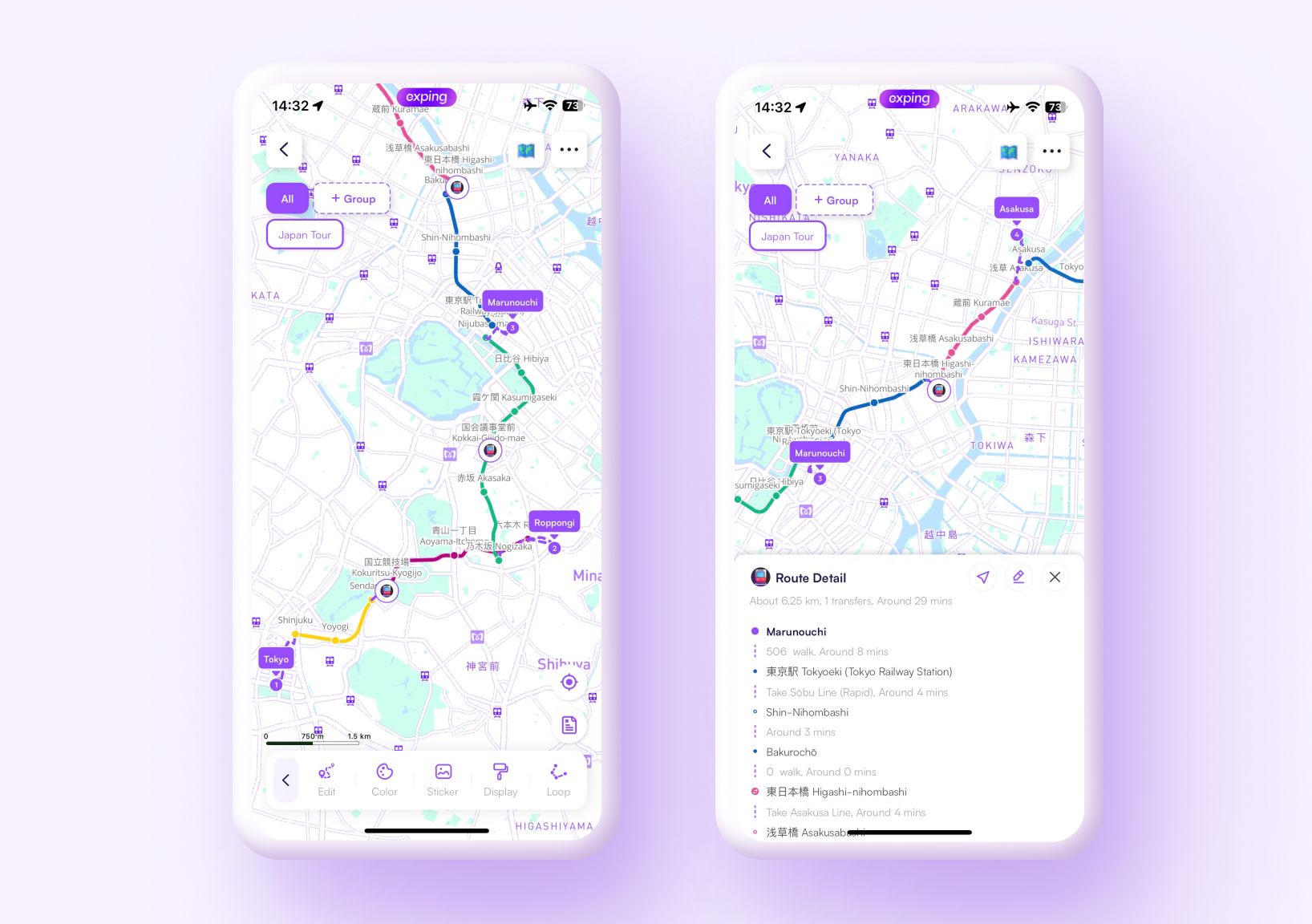
Transit Display
Whether you’re commuting daily or exploring a new city, get detailed bus and subway route info with ease.
- Displays station info for subway and bus lines
- Provides detailed transfer information
- Shows estimated travel times between stations
- Displays routes in the actual colors of subway lines
How to Use the Transit Feature?
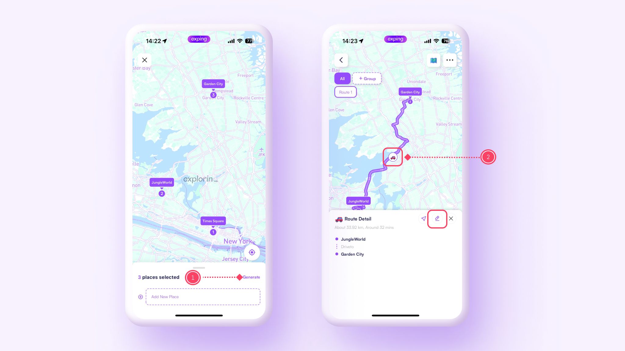
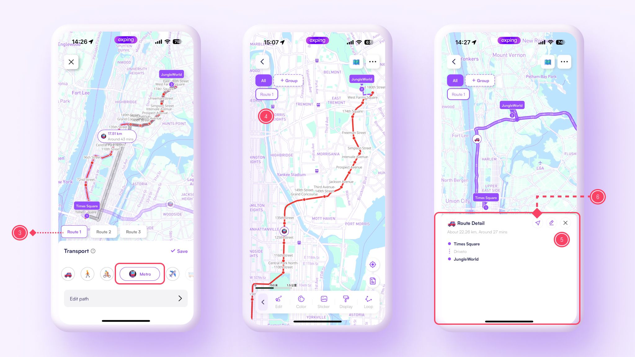
- On the editing page, use "Routes" - "Auto Plan" to add places for route generation, then tap "Generate Route".
- In the generated route, tap the "Transportation" icon, then the "Modify" icon.
- On the "Transport" page, select the subway or bus icon, and choose the appropriate route from the alternatives, then tap "Save".
- On the route details page, zoom in to switch to the public transportation route view.
- Tap the "Transportation" icon on the route to access the "Route Detail" page for detailed transport routes.
- Tap the "Navigation" icon to start navigating the complete route.
💡 Only routes generated with the latest version support detailed station displays.
User Case - Transit Route
Japan Travel Route Map
Marker Colors
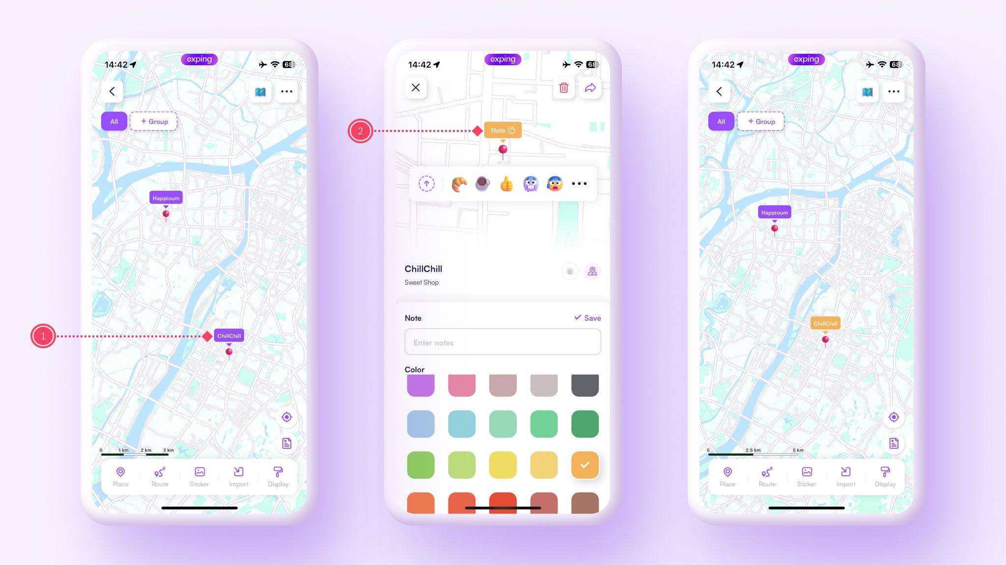
With v1.9.7, you can now freely change place marker colors, making your travel planning and exploration even more personalized. Modify each place marker’s color based on your preferences and schedule, allowing for quick identification and differentiation of places.
Change One Place Color
- Tap the place you want to change the color for and go to the place details page.
- Tap "Notes" above the marker, choose the desired color, and save it.
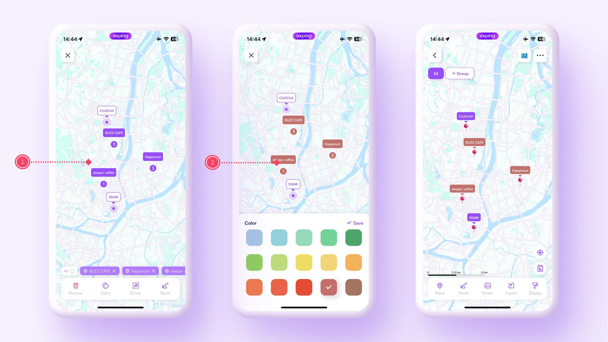
Change Multiple Marker Colors
Select Multiple Place
- Long press one of the places you want to change the color for, then tap all the places you want to modify.
- Tap the bottom toolbar "Color", select the desired color, and save it.
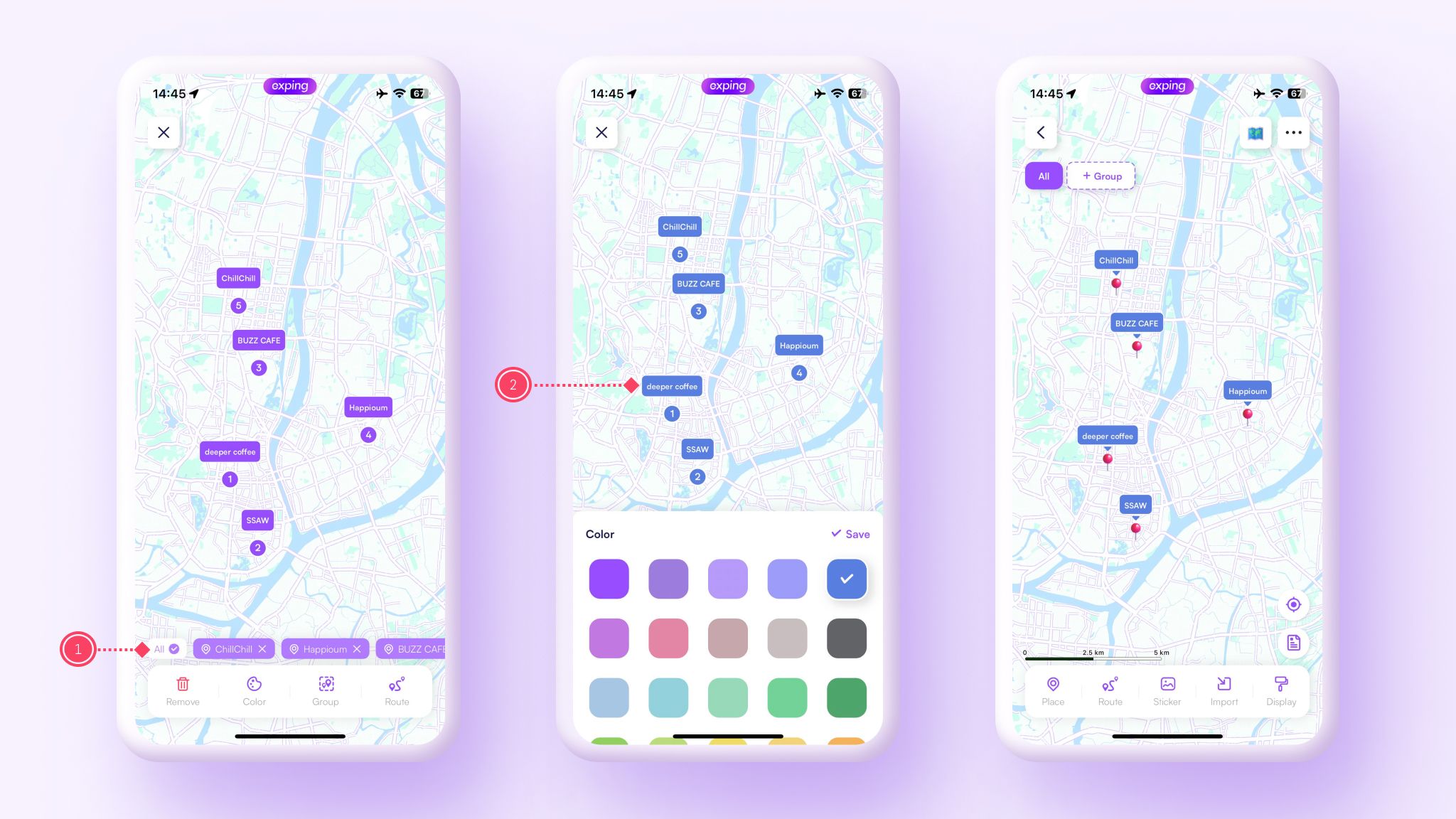
Select All Places
- Long press one of the places you want to change the color for, then tap the "All" option on the left.
- Tap the bottom toolbar "Color", select the desired color, and save it.
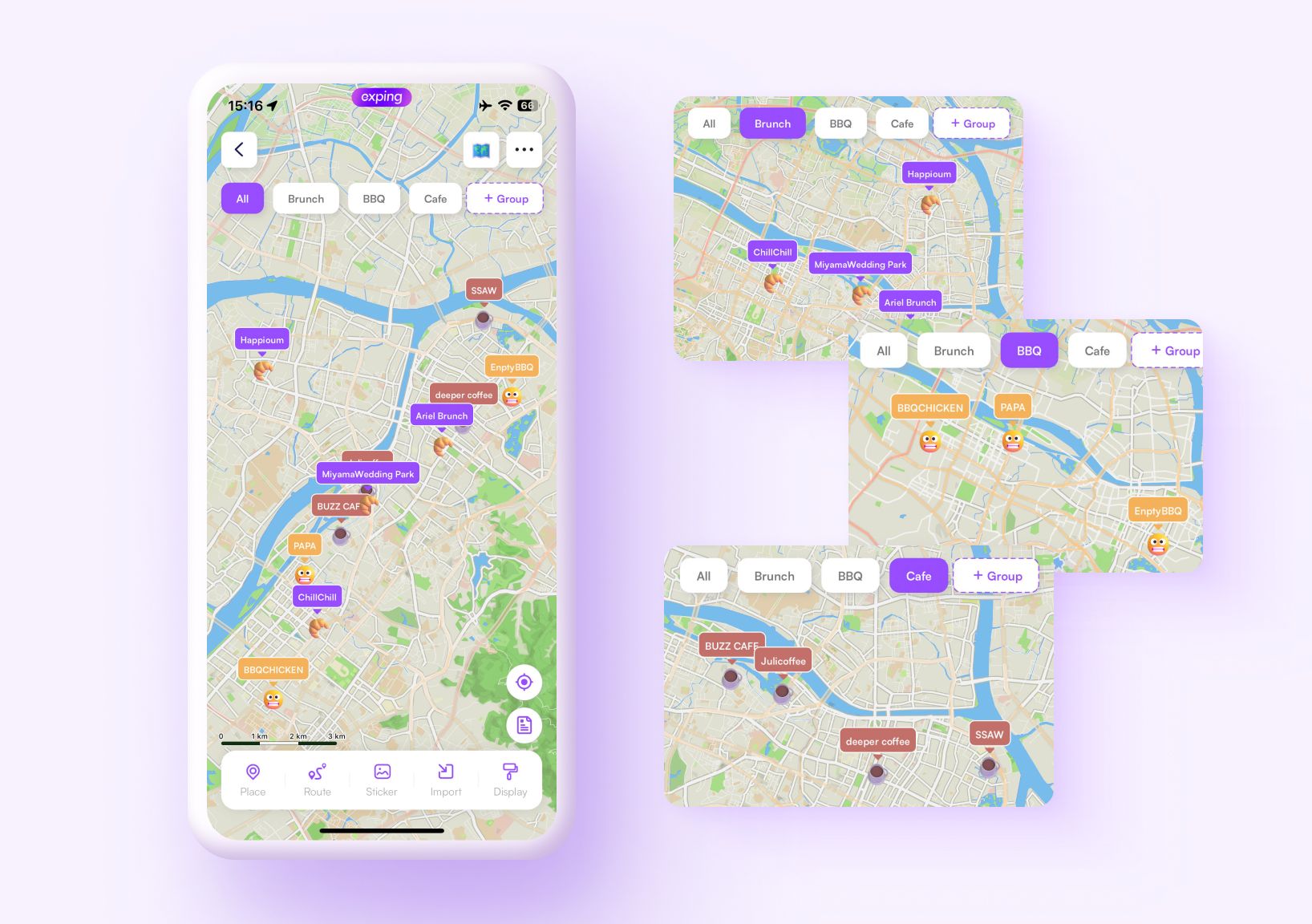
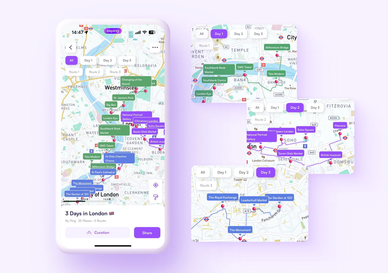
User Cases - Marker Colors
Foodie Map
Use marker colors to differentiate various types of dining spots.
London Itinerary
Use marker and route colors to differentiate daily itineraries and tourist attractions.
Share